Inca Trail Elevation, Distance, and Difficulty
The Inca Trail elevation is one of the most important things to understand before hiking the Classic Inca Trail to Machu Picchu. The route is famous for its ancient stone paths, archaeological sites, cloud forests, and spectacular mountain scenery, but its physical challenge comes largely from the constant changes in altitude.
The Inca Trail 4 Days to Machu Picchu reaches its highest point at 4,215 meters (13,829 feet) above sea level at Warmiwañusca, better known as Dead Woman’s Pass. From the starting point at Km 82, the trail climbs gradually on the first day, makes its biggest elevation gain on Day 2, crosses several high passes on Day 3, and then descends toward Machu Picchu on the final day.
Understanding the Inca Trail elevation profile is more useful than looking only at the total distance. A day with fewer kilometers can still be physically demanding if it includes a steep climb, while a longer day can feel easier when most of the route is descending.
Below is a day-by-day look at the Inca Trail altitude, elevation gain, elevation loss, highest points, and difficulty.

Inca Trail Elevation at a Glance?
The Classic Inca Trail starts at approximately 2,700–2,720 meters (8,858–8,924 feet) at Km 82 and eventually reaches Machu Picchu at approximately 2,430 meters (7,972 feet). The highest point is Dead Woman’s Pass at 4,215 meters.
Hikers often face difficulty hiking the Inca Trail, mostly due to its high points and ascends. Therefore, acclimatizing to its high-altitude treks before embarking them on is key if you are unfamiliar with the height.
| Day | Route | Approx. Highest Elevation | Approx. Elevation Gain | Main Elevation Loss | Difficulty |
|---|---|---|---|---|---|
| Day 1 | Km 82 → Wayllabamba | 3,000 m. | 250–400 m | Minimal | Moderate |
| Day 2 | Wayllabamba – Dead Woman’s Pass – Pacaymayo | 4,215 m | 1,200 m | 600 m | Challenging |
| Day 3 | Pacaymayo – Runkurakay – Phuyupatamarca – Wiñay Wayna | 3,950 m. | 450 m | 1,000 | Challenging |
| Day 4 | Wiñay Wayna – Sun Gate – Machu Picchu | 2,730 m. | 100 m. | 200–300 m | Moderate Easy |
These figures are approximate because the exact elevation gain and loss can change depending on the precise starting and ending points used for each day’s calculation. What matters most is understanding the pattern: gradual ascent on Day 1, major climb on Day 2, repeated ups and downs on Day 3, and a much lower final section on Day 4.
Day 1: Km 82 to Wayllabamba
- Starting elevation: approximately 2,720 m (8,924 ft)
- Highest elevation: approximately 3,000 m (9,840 ft)
- Elevation gain: approximately 250–400 m
- Elevation loss: relatively small
- Difficulty: Moderate
The first day of the Inca Trail 4 Days is generally considered the easiest stage of the route. The trail begins at Km 82 and follows the Urubamba and Cusichaca river valleys before gradually gaining elevation toward Wayllabamba.
Compared with the following days, the Inca Trail elevation gain on Day 1 is relatively modest. Depending on the exact route and measurements, the total ascent is generally around a few hundred meters. Some published route profiles calculate approximately 720 meters of total ascent, while others calculate only the net elevation change between the start and camp. This difference is why elevation figures can vary between Inca Trail tours maps and tour operators.
The important point is that Day 1 is designed naturally as an introduction to the trail. You gradually move from the lower valley toward the mountains and finish at approximately 3,000 meters.
Although this day is not the hardest, it is important because it gives you an opportunity to see how your body responds to increasing altitude before the much bigger climb on Day 2.
Day 2: Wayllabamba to Dead Woman’s Pass to Pacaymayo
- Starting elevation: approximately 3,000 m (9,840 ft)
- Highest elevation: 4,215 m (13,829 ft)
- Elevation gain: approximately 1,200 m
- Elevation loss: approximately 600 m to Pacaymayo
- Difficulty: Very challenging
Day 2 is the key day when discussing Inca Trail elevation and difficulty.
From Wayllabamba, the trail climbs steadily toward Llulluchapampa and then continues toward Warmiwañusca, or Dead Woman’s Pass. At 4,215 meters, this is the highest point on the Classic Inca Trail.
The elevation gain from Wayllabamba to Dead Woman’s Pass is approximately 1,200 meters. That is a substantial climb, especially because it takes place over a relatively short section of trail and includes long sequences of stone steps.
This is why Day 2 is considered the hardest day of the Inca Trail.
The challenge is not simply reaching 4,215 meters. As you climb higher, the air becomes thinner, and the effort required for each step increases. The final approach to Dead Woman’s Pass can feel particularly demanding because the trail becomes steeper and the surrounding vegetation becomes much more sparse.
But reaching the pass is not the end of the day.
After reaching 4,215 meters, you must descend approximately 600 meters toward the Pacaymayo Valley. This descent is steep in places and can put considerable strain on the knees and legs after the morning climb.
The route then climbs again toward Runkurakay, which reaches approximately 3,950 meters.
So Day 2 contains both a major elevation gain and elevation loss, making it the most demanding section of the Inca Trail 4 Days to Machu Picchu.
Day 3: Pacaymayo to Wiñay Wayna
- Starting elevation: approximately 3,600 m
- Highest elevation: approximately 3,950 m
- Main elevation loss: more than 1,000 m depending on the route and measurement points
- Difficulty: Challenging
Many hikers assume that Day 3 will be easy because the highest point of the Inca Trail has already been crossed. That is not necessarily the case.
Day 3 begins in the Pacaymayo Valley and climbs again toward Runkurakay Pass, at approximately 3,950 meters. From there, the trail continues toward Sayacmarca and later climbs toward Phuyupatamarca, at approximately 3,650–3,680 meters.
The important difference is that Day 3 is not one enormous climb like Day 2. Instead, it consists of multiple elevation gains and losses.
You climb, descend, climb again, and then gradually lose altitude as the trail enters the cloud forest.
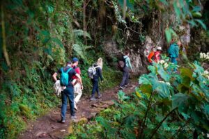
Eventually, the route descends toward Wiñay Wayna, located around 2,650–2,700 meters depending on the campsite and measurement used. This means the latter part of the day involves a significant descent from the higher passes into a much warmer and greener environment.
For this reason, Day 3 can be challenging even though you do not reach the maximum elevation of the previous day.
The combination of multiple passes, stone steps, archaeological sites, and a long descent makes this one of the most varied days of the Inca Trail elevation profile.
Day 4: Wiñay Wayna to Machu Picchu
- Starting elevation: approximately 2,650–2,700 m
- Sun Gate elevation: approximately 2,720–2,730 m
- Machu Picchu elevation: approximately 2,430 m
- Elevation gain: minimal
- Elevation loss: approximately 250–300 m
- Difficulty: Easy to moderate
The fourth day is very different from the first three.
You leave Wiñay Wayna early and follow the final section of the Inca Trail toward Inti Punku, the Sun Gate. The trail climbs slightly toward the Sun Gate, which sits at approximately 2,730 meters.
From there, the route continues toward Machu Picchu and gradually descends.
The Machu Picchu elevation is approximately 2,430 meters (7,972 feet), meaning you finish the trek considerably lower than the highest point reached on Day 2.
The elevation gain on Day 4 is therefore very small compared with the previous days. The physical challenge comes more from the early start, the accumulated fatigue from three days of hiking, and the many stone steps along the final section.
For most trekkers, however, Day 4 feels easier because the trail is shorter and the altitude is significantly lower.
And, of course, there is one major motivation: Machu Picchu is waiting at the end.
Inca Trail Elevation Gain and Loss
One of the most important things to understand about the Inca Trail elevation gain and loss is that the route is not a simple climb from Cusco to Machu Picchu.
The elevation profile looks more like a series of mountains and valleys.
You begin around 2,720 meters at Km 82 and climb gradually toward Wayllabamba. On Day 2, the trail makes its biggest ascent, reaching 4,215 meters at Dead Woman’s Pass before dropping toward Pacaymayo.
Day 3 brings another climb toward approximately 3,950 meters before the trail gradually descends through the cloud forest toward Wiñay Wayna.
Finally, Day 4 takes you from approximately 2,650 meters to the Sun Gate and then down toward Machu Picchu at 2,430 meters.
This means the total elevation gained during the entire trek is considerably greater than the simple difference between the starting and ending elevations. You repeatedly climb after descending, which is why the Inca Trail can feel physically demanding despite its relatively modest overall distance.
What Is the Highest Elevation on the Inca Trail?
The highest elevation on the Inca Trail is 4,215 meters (13,829 feet) at Dead Woman’s Pass, or Warmiwañusca.
This is the highest point of the Classic Inca Trail and the main reason altitude becomes such an important part of the trek’s difficulty.
The second major high point is Runkurakay Pass, at approximately 3,950 meters. Phuyupatamarca is lower, at roughly 3,650–3,680 meters.
After these high passes, the route loses elevation as it enters the cloud forest.
Which Day Has the Biggest Elevation Gain?
Day 2 has by far the most significant single elevation gain.
From Wayllabamba at approximately 3,000 meters, you climb to Dead Woman’s Pass at 4,215 meters, an ascent of roughly 1,200 meters.
That is why Day 2 is widely considered the hardest day of the Inca Trail 4 Days to Machu Picchu.
However, Day 3 should not be underestimated. Although its individual climbs are smaller, the repeated ascents and descents can make it tiring, particularly after completing the demanding second day.
Which Day Has the Most Elevation Loss?
Day 3 generally contains the most significant sustained elevation loss because the trail descends from the higher mountain passes into the cloud forest and eventually reaches Wiñay Wayna at around 2,650 meters.
Day 2 also has an important descent: after reaching Dead Woman’s Pass at 4,215 meters, hikers descend approximately 600 meters toward Pacaymayo before climbing again.
Day 4 has comparatively little elevation change. From Wiñay Wayna, you make a small climb toward the Sun Gate and then descend toward Machu Picchu.
Therefore, when considering Inca Trail elevation loss, Day 2 and Day 3 are the days where your legs experience the greatest amount of downhill hiking.
Inca Trail Elevation and Difficulty: Day-by-Day Summary
The Inca Trail difficulty changes significantly throughout the four-day route.
Day 1 – Moderate: A gradual introduction with moderate elevation gain toward Wayllabamba.
Day 2 – Very challenging: The hardest day because of the major ascent to 4,215 meters, followed by a steep descent and another climb.
Day 3 – Challenging: Several mountain passes and substantial elevation loss through the cloud forest make this a long and varied day.
Day 4 – Easy to moderate: A shorter final section with minimal elevation gain and a gradual descent toward Machu Picchu.
The most difficult part of the trek is therefore not simply the number of kilometers walked. It is the relationship between altitude, elevation gain, elevation loss, steep stone steps, and consecutive days of hiking.

Short Incs Trail 2 Days as the Best Option
For those seeking a short adventure and having limited time. The Short Inca Trail 2 Days is the best alternative to the Classic 4-Day route, offering a shorter trek, stunning scenery, Wiñay Wayna, and Machu Picchu. Short-distance hike, arrive at Machu Picchu through the Sun Gate. Great for families with kids.
Final Consideration on the Inca Trail Elevation
Understanding the Inca Trail elevation gives you a much clearer picture of what the Classic four-day trek is really like.
The route begins at approximately 2,720 meters, climbs gradually on Day 1, reaches its highest point of 4,215 meters at Dead Woman’s Pass on Day 2, crosses additional high passes on Day 3, and finally descends toward Machu Picchu at approximately 2,430 meters.
The biggest Inca Trail elevation gain happens on Day 2, while Day 3 combines repeated climbs with substantial elevation loss. Day 4 is comparatively short and lower in altitude.
For travelers considering the Inca Trail 4 Days to Machu Picchu, looking at the elevation profile is one of the best ways to understand the physical demands of the journey.
It is not simply a 43-kilometer walk.
It is a four-day journey of climbing, descending, crossing high mountain passes, and continuously changing altitude, and that dramatic elevation profile is a major part of what makes the Inca Trail such a memorable route to Machu Picchu.